Ben R. Hodges
University of Texas at Austin
Representing hydrodynamically-important blocking features in coastal or riverine lidar topography
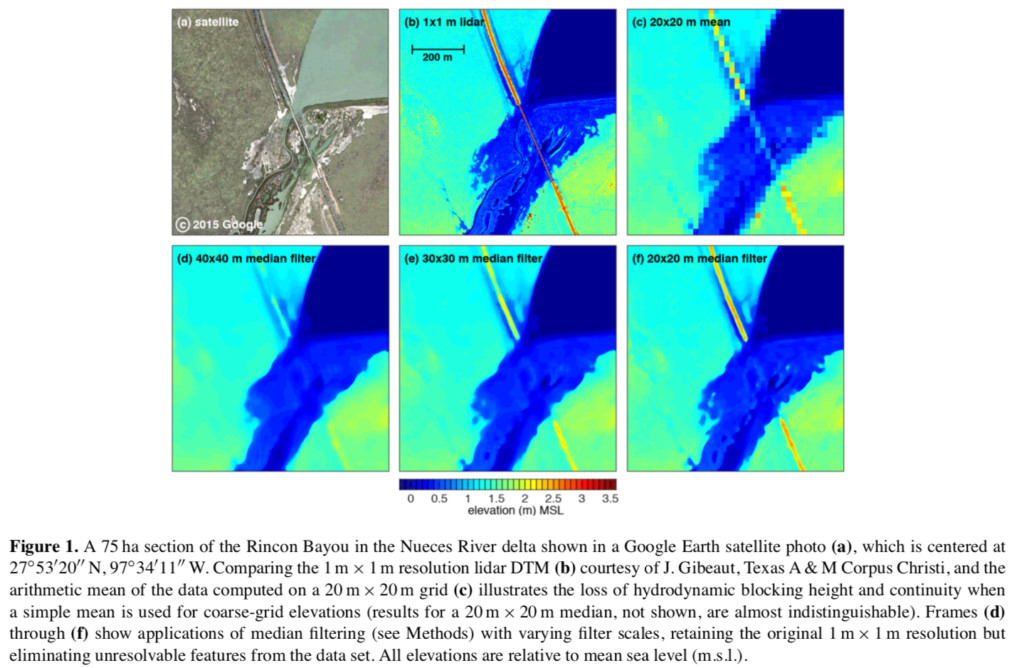
ABSTRACT: New automated methods are developed for identifying narrow landscape features that cause hydrodynamic blocking and might have critical impacts for management models of river flooding, coastal inundation, climate change, or extreme event analysis. Lidar data processed into a fine- resolution raster (1 m × 1 m) can resolve narrow blocking features in topography but typically cannot be directly used for hydrodynamic modeling. For practical applications such data are abstracted to larger scales, which can result in a loss of hydrodynamic blocking effects. The traditional approach to resolving hydrodynamic blocking features is to represent them as cell boundaries within a customized unstructured grid that is tuned to the spatial features. A new automated edge-blocking approach is developed, which allows application of an arbitrarily structured (Cartesian) mesh at coarser scales and provides contiguous representation of blocking features along Cartesian cell boundaries. This approach dis- torts the shape of a blocking feature (i.e., making it rectilinear along grid cell faces) but retains its critical hydrodynamic blocking height characteristics and spatial continuity within the topographic model.