Identification of submerged large woody debris from single-beam echo soundings
ABSTRACT: Submerged large woody debris (LWD) in rivers and streams appears as spikes in bathymetry data collected at a decimeter resolution with a single-beam echo sounder. The LWD signal distorts any subsequent interpolation of bathymetry to an hydraulic model mesh or to a triangulated irregular network (TIN) for Geographical Information Systems (GIS). Two methods for separating the submerged LWD from the background bathymetry are investigated: 1) a new σ-discrimination method and 2) an adaptation of prior scale-space analysis techniques. The former is shown to effectively separate LWD from the background bathymetry. However, the latter is shown to be ineffective for this purpose. Separation of the background bathymetry and LWD signal allows the quantity and distribution of LWD to be separately mapped, providing a resource for biologists, geomorphologists and hydraulic engineers whose studies may be affected by the presence of LWD.
EXTRACT:

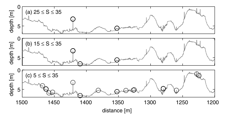
Figure 11. LWD discrimination for section of Sulphur River bathymetry by scale-space analysis for fixed arch width window 5 < W < 100 cm and varying smoothing level window S.

